Photos and Maps of the 9-Foot Project
In the months and years leading up to the 9-foot project, the United States Army Corps of Engineers took up the considerable task of documenting the Upper Mississippi River’s social and ecological condition. In doing so, the Army Corps participated in an act of “legibility” wherein the agency “took exceptionally complex, illegible, and local social practices (and ecological systems),” simplified them, and took them under their domain (James Scott, Seeing Like a State 1998, p. 2).
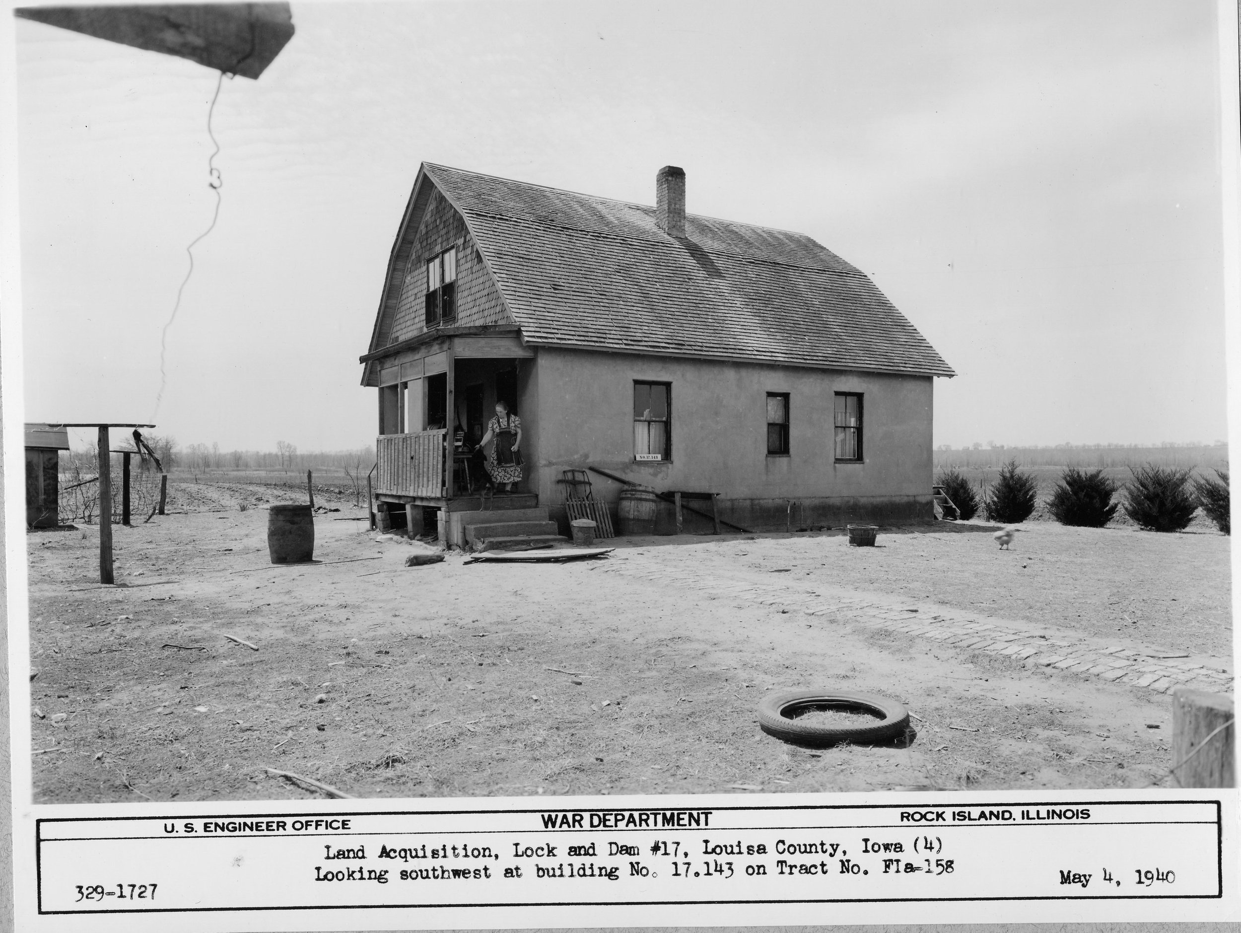
It was a monumental effort. These maps (known as the plane table maps) and photos formed the basis for the Corps’ property condemnation scheme.

Plane Table Map 17-PT-23. The map was completed between 1938 and 1940.
The Army Corps began debating how best to cartographically describe the Upper Mississippi River late in the 1920s and by 1933 the Corps had decided on the costly, but highly accurate plane table method. Plane table mapping involves the preparation of the map in the field using a series of direct observations and measurements. And this differs of course from other survey methods where the map is completed in another location off of surveyors notes. Plane table mapping found its roots in the 1600s and was brought to the United States by cartographer and surveyor Ferdinand Hassler.

Army Corps GIS Specialist Chris Hawes described the Corps’ use of the plane table: “Plane table maps were created by using a plane table and an adelaide. The plane table was mounted on a tripod which allowed the board to be precisely located on top of a point and leveled; the adelaide was then used to take measurements which could be recorded on sheets mounted to the table. These sheets, in MVR’s (Army Corps) case were then brought into the office and expertly inked to produce a final map.” The maps are large scale - most are 1 = 200 feet. Since the maps were used to estimate potential flood and flowage damage it was critical that they be highly accurate. The plane table maps show 1 foot topographical contour lines - an attention to detail that exceeded the standard of the times. Army Corps engineers used the plane table maps to help calculate just how much of this floodplain would be inundated by the new normal water levels. And after much debate, they calculated a two-year flood recurrence interval and added three feet of elevation as a buffer.

A clip from plane table map 18-T-36. Note the contour lines and land use descriptions (timber, corn etc).
And of course, any property that fell within that flood interval buffer was placed under United States Army Corps control through purchase and / or eminent domain condemnation procedings. In the process, the Army Corps became the largest public land manager in the Mississippi River corridor. About half of the condemned land remains more or less permanently under water. The remaining acres are the Army Corps Upper Mississippi public lands.
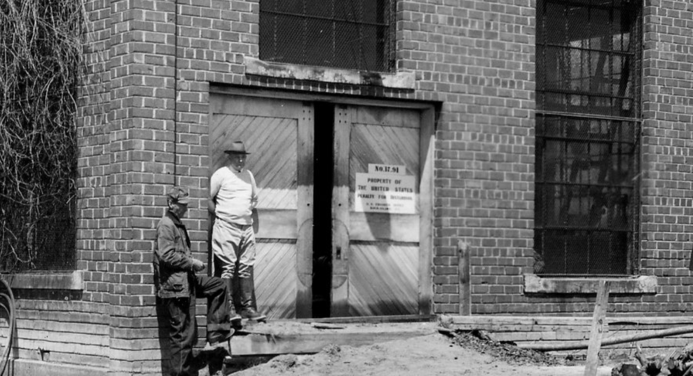
To accompany the plane table maps and extend this act of legibility, the Army Corps sent out crews of photographers. They took thousands of photos up and down the Upper Mississippi River documenting landscapes and fields and every standing building. These photos were entered into evidence in the condemnation proceedings and were used to gauge value and to lay claim to the property.

Members of the Army Corps Photographic Survey, 1937