A Walk Along the Port Louisa Shore: Photo set 1724. Pool 17. The eastern edge of the Louisa District, Port Louisa National Wildlife Refuge.

The Port Louisa region was a complex social and ecological community. It is prime fertile floodplain. Here, the bluff line is well back from the river - as much as two miles at some points. Local histories proclaim that the area was platted out as a formal township in the 1840s. By the early 1850s, “Port Louisa was thought to be destined to be quite an important place. It had the only good landing on the Mississippi River in this country. It also had a most complete sawmill establishment; and there was a good steam grist mill but a short distance from there. There was usually a large amount of pine lumber on hand at the sawmill, being brought down by rafts on the Mississippi” (Springer 1912, 293).


By the 1930s, much of the Port Louisa shoreline had been broken into small landholdings. In order to farm the floodplain, the county and land owners formed a drainage district. A levee and pumps were built to keep floodwaters out. The property between the levee and river mostly shifted from traditional riverfront economies to recreation, though a steam locomotive lumber mill still shaped pine and maple and oak trees into board feet near Michaels Creek.

My walk along the Port Louisa shore took place over two days. The first was one of the last days of our short fall break. I had waited anxiously for the leaves to fall but fall was late this year and the leaves hung on with an ardent stubbornness. Two days earlier the wind had picked up along the Mississippi corridor and I thought, “Finally!” The next day brought rain. Even better. The morning of November 8 was drizzly but it cleared to sunshine in the afternoon and I went out to walk along the Port Louisa shoreline. The leaves were still hanging on, unwilling to just let go.

The second leg took place in a different season. It was cold and clear February 20th - the thermometer on my car registered 18 degrees as I pulled on my gear. I was worried about my camera and kept it zipped up between my chest and coat and wrapped in a scarf. But I was completely alone as I walked past recreation houses shuttered for the winter. I kept to the crest of the levee for as long as I could - on my right lay a thin floodplain forest that was still subject to rising waters and summer cabin enthusiasts. To my left were eagles and beaver and fox prints and the wetland pools just north of the Port Louisa Wildlife Refuge. I walked on both sides of the levee as far as I could, until fallen trees, erosion, and February cold forced me back to my car.

Take Aways:

Land Use: Recreational Landscapes - A case will be made that the 9-foot project initiated a river-long human land use transformation away from settled industrial, agricultural, and resource-based landscapes - where people lived year-round, formed distinct communities, and were connected to the river and floodplain through their livelihoods - towards seasonal leased, perhaps temporary, recreation landscapes. Along the northern stretch of the Louisa shore, on either side of Michaels Creek, that transformation had already begun courtesy of a low-lying levee and the agricultural demands of the Louisa Levee District. Michaels Creek is located at the bend in the river where it angles west to east and the river easily floods. The early levee provided a high ground for cabin-building and river access was a strong lure to recreation- and river resource-minded locals.

By 1938 the U.S. Army Corps of Engineers divisions in charge of the 9-foot project recognized that they had a problem. Through condemnation (eminent domain), purchases, and flowage easements they had taken control of tens of thousands of miles of Upper Mississippi floodplain. And now they had to manage them. It was a daunting order; the Army Corps was just not set up to be a public land management agency in the vein of the United States Forest Service or the Bureau of Land Management (then known as the Grazing Service). They developed a fief-like land management imperative that is, in the large, still active today. The Army Corps remained as the agency-in-charge of the Upper Mississippi shoreline - but others were actively in charge. They dispersed land to state and municipal governments. They partnered with other federal agencies - like the U.S. Fish and Wildlife Service and gave them near carte blanche authority to shape shorelines for fish and waterfowl. They leased out small slips of land to locals for recreation. Through the late 1930s, the Army Corps advertised several sealed-bid auctions to lease the land that had been, until very recently, owned. As such, we begin to see a significant social reordering of the Upper Mississippi shore.

The landscape just north of Michaels Creek is a leased recreation community all its own. Users lease land from the Army Corps of Engineers for an annual fee. Lessees can build on the land, though the Army Corps is indemnified from any damages to that property brought by the rising water. Build at your own risk. Nevertheless, it isn’t hard to imagine a warm, humid summer night on a levee bordering the Mississippi River and families filling porches, frying catfish, and building deep and meaningful connections to place and people.

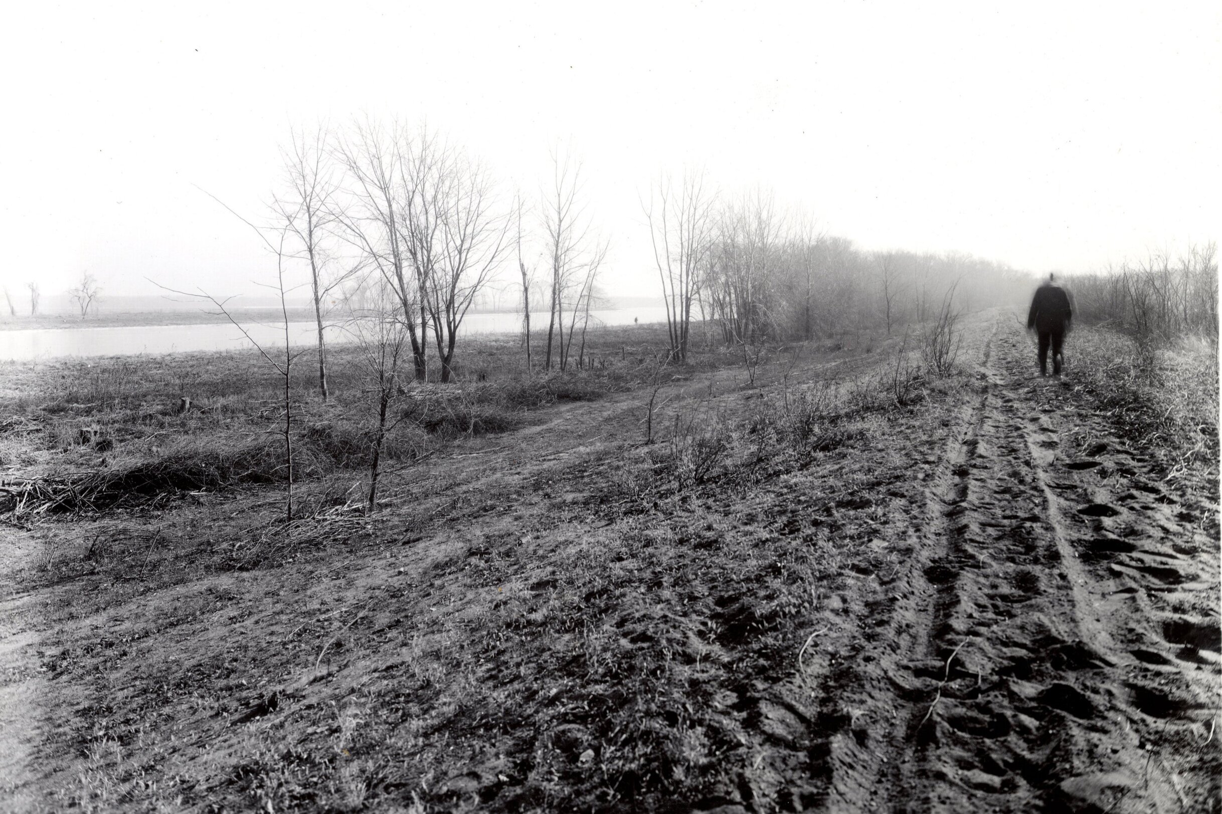
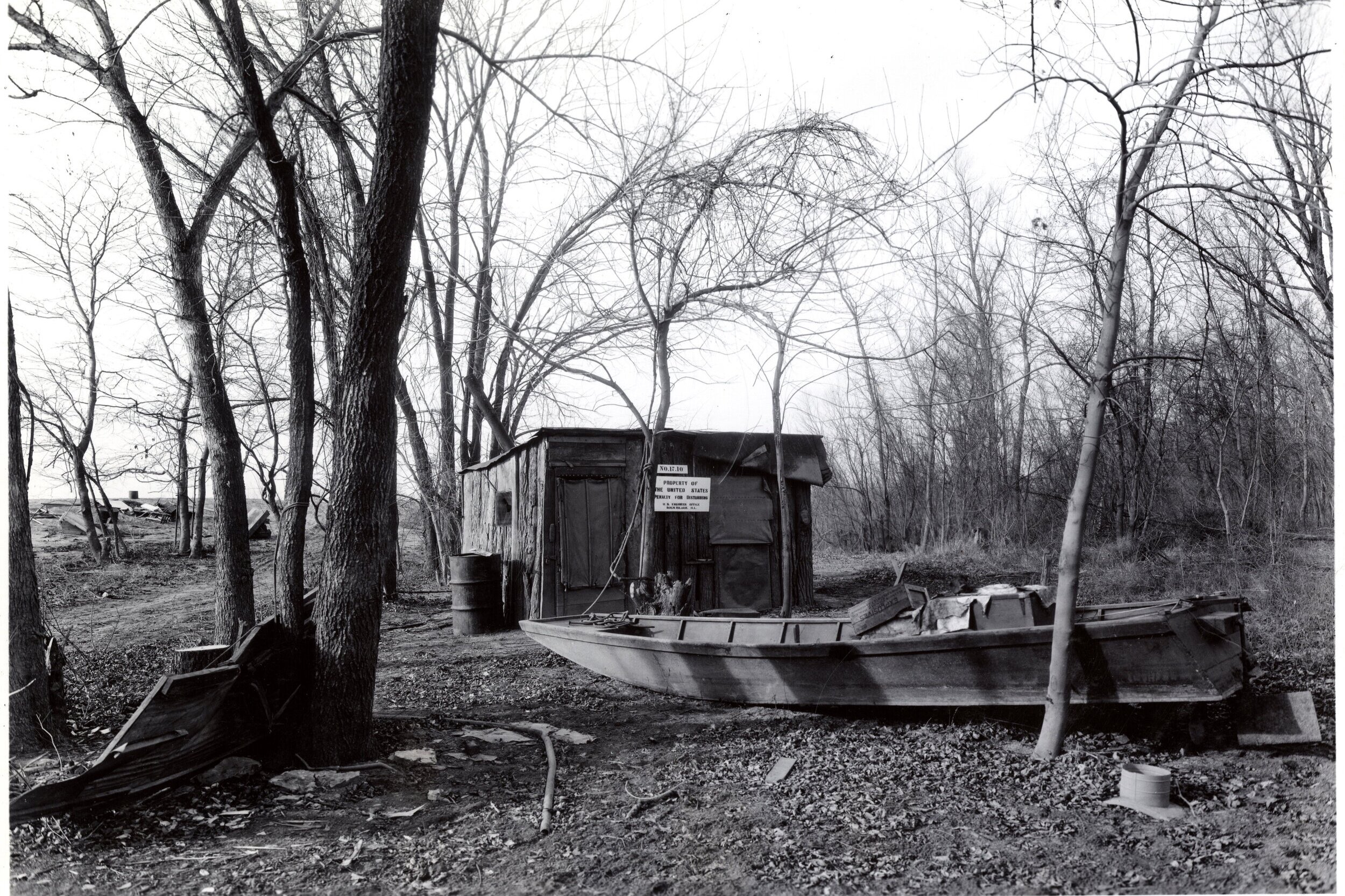
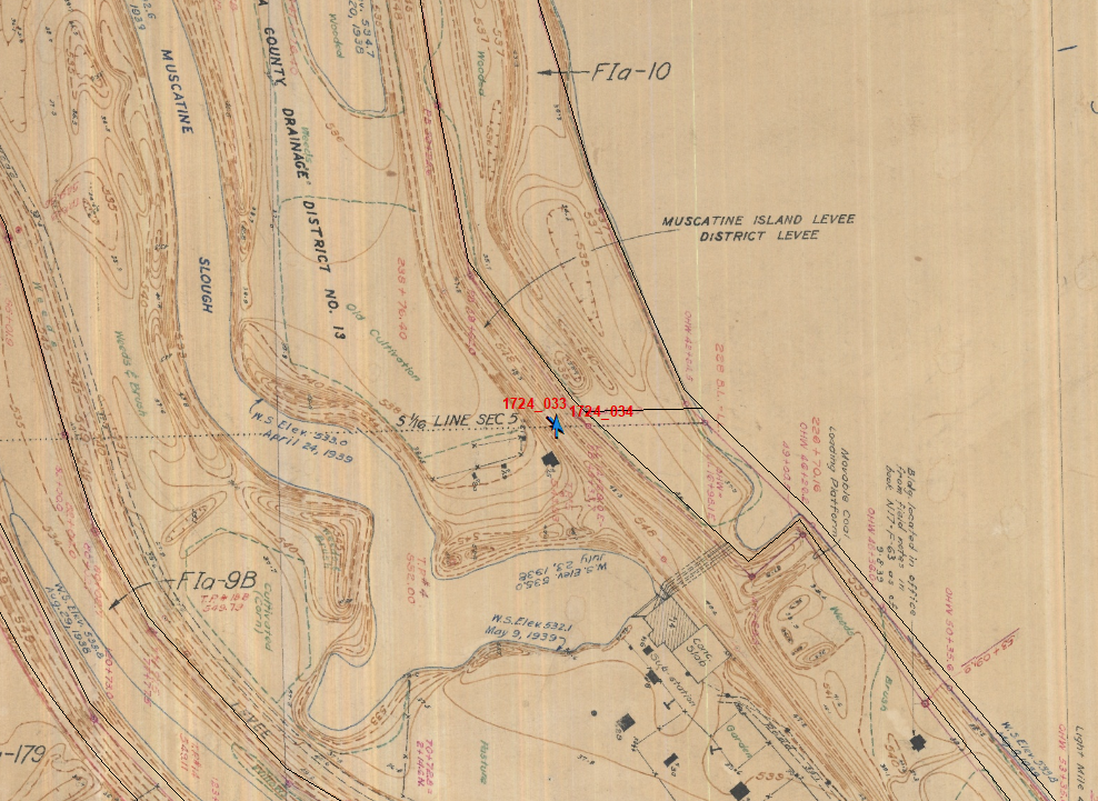
Repeat photography of photos 33-1724 and 34-1724 (below) show that the landscape was oriented towards recreation; though no structures are seen in the photo, we can see that the the floodplain was clear and a boardwalk to a pier was constructed for access. The plane table maps shows the Muscatine Island Levee District Levee, its pumping facilities, and cultivated landscapes between the levee and the slough. The land was owned by “A.J. Wheeler and Wife.” Andrew Jackson Wheeler was born in Louisa County in 1878. His wife, Alice Nott Wheeler, was born in Fairfield, IA in 1879 and married A.J. when she was 18 years old. They lived in Wapello, IA and had three sons (Omer, Chester, and Jack) and four daughters Helen, Maybelle, Inez, and Anna. A.J was a Mason and in nearly every newspaper account I could find, Alice was only mentioned as “Mrs. A.J. Wheeler.” Like all landowners along the Louisa shoreline, the Wheelers lost title to the land during the 9-foot project condemnation process.

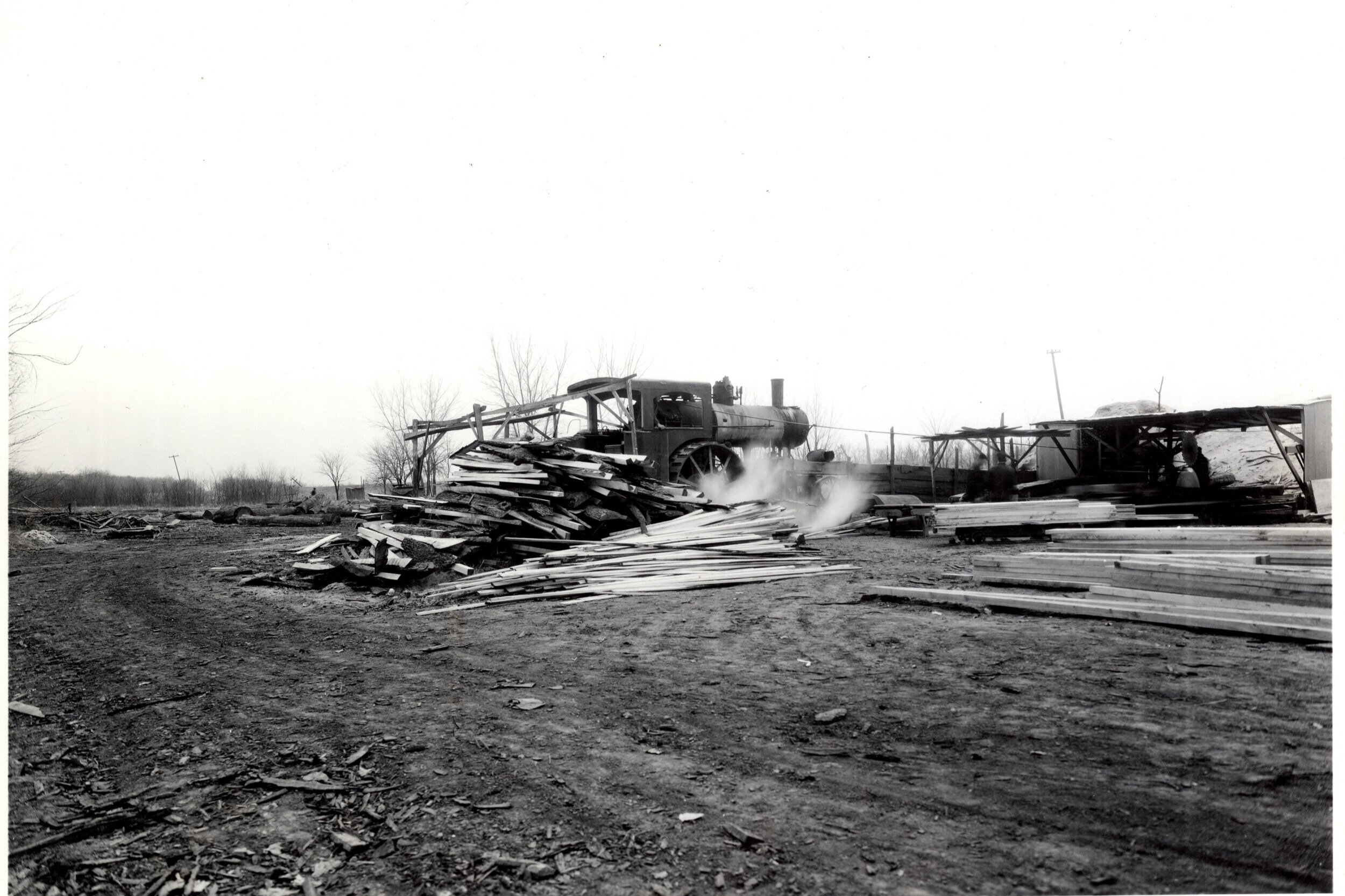
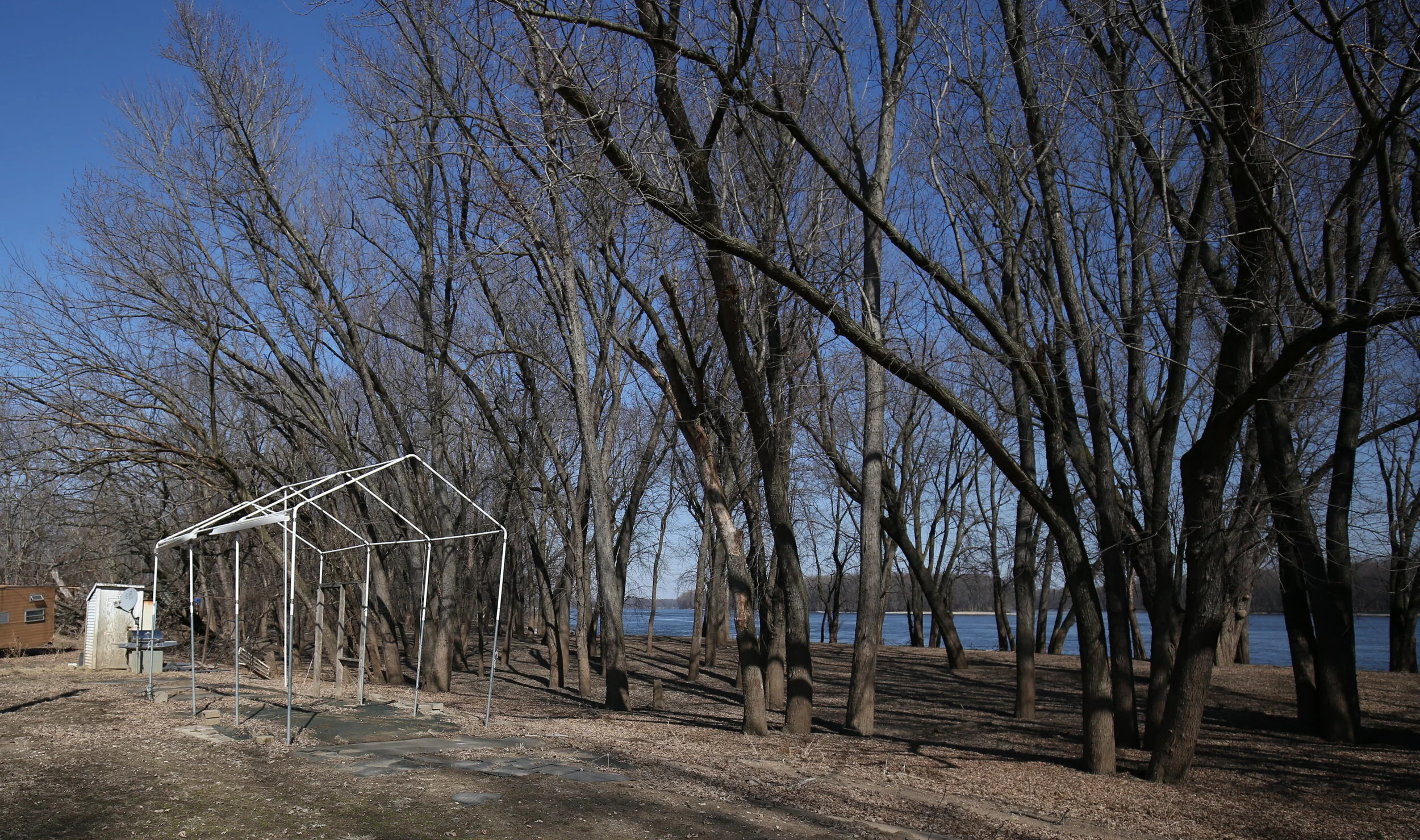
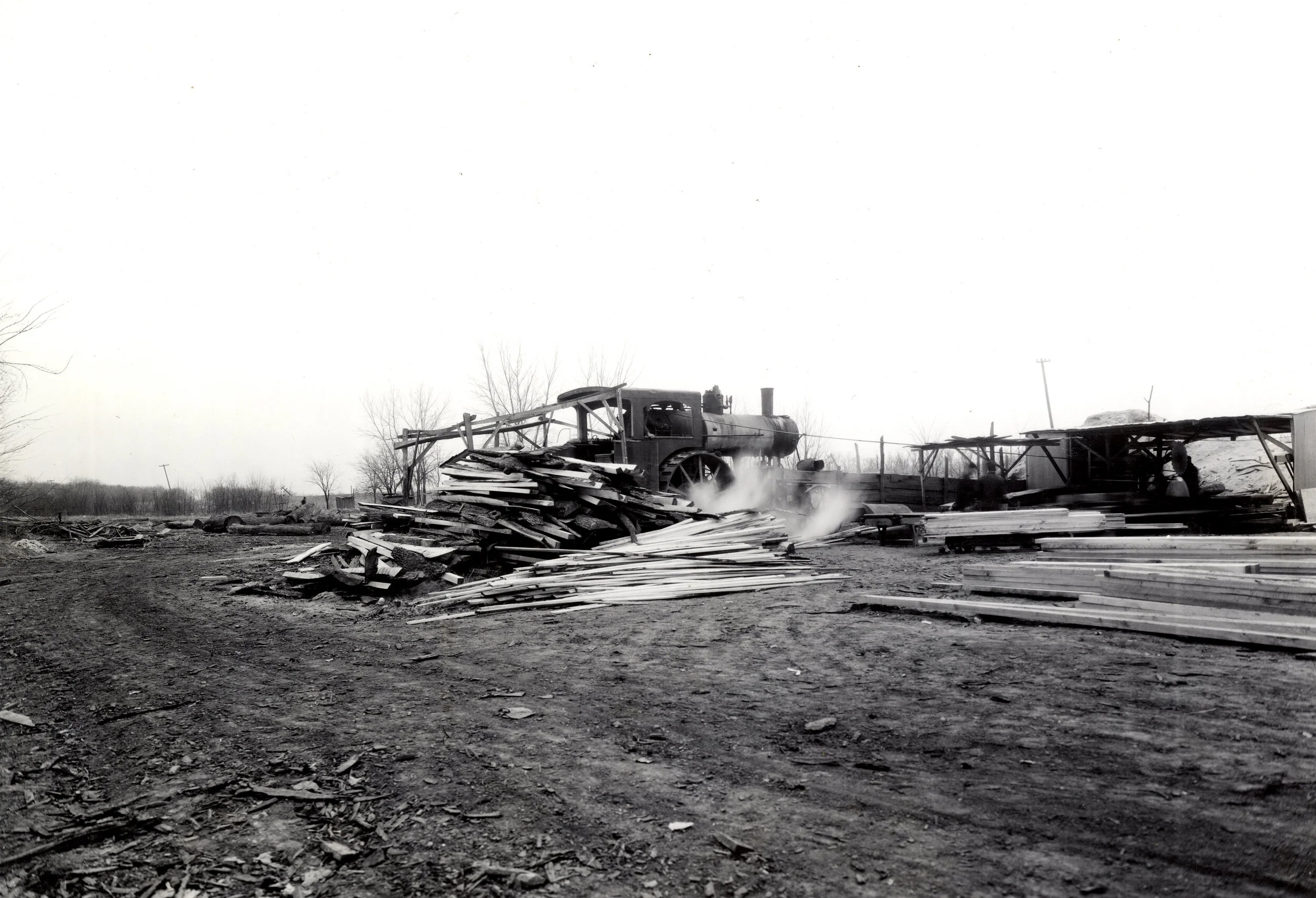
The portable saw mill is of course gone. In its place is an active boat ramp. I always see people there - no matter what time of year or the temperature. Yesterday I saw two middle-aged hispanic men chip away ice from one of the ponds behind the ramp and spool out line from small ice fishing rods. They jigged for small blue-gill. “The small ones are best. Good soup!”